Trek to the Beyul of Pemako
A challenging once-in-a-lifetime adventure, this phenomenal trek to the mystical realm of the Beyul of Pemako is suitable for pilgrims, explorers, adventure enthusiasts and naturalists.
Ages and centuries ago, hidden texts were discovered throughout Tibet describing beyul, hidden lands where the preaching of Buddhist Tantras would be preserved for future generations. It was eighth-century adept magician Padmasambhava, known as Guru Rinpoche, who hid these scriptures deep in the valleys of the Himalayas, meant to be found by only those who had a vision. Beyuls are paradises on earth which can be reached by overtaking hardship. Pilgrims, who travel to these distant out-worldly places in the heart of the Himalayas, often tell tales of undergoing extraordinary experiences, similar to those encountered by beings who choose the Buddhist path to liberation.
The most renowned and mystical of all the hidden-lands is Beyul Pemako, “the hidden land the shape of a lotus”, a celestial realm on earth. Many pilgrims have journeyed here in search of inner wisdom, not to escape the world, but to enter it more deeply, and become aware of secrets of the mind and spirit. With good intentions and merit, a pilgrim in Pemako learns to see the world differently than what appears, bringing him closer to the virtues of wisdom and compassion. It is believed that it is in Pemako that humanity will survive and thrive at the end of the world.
Pemako is the earthly form of Dorje Pagmo, the queen of all dakinis (female spirits). Her head is the Kangri Karpo, her two breasts are the peaks of Namcha Barwa and Gyala Pelri. The lower part of her body lies in Yangsang or innermost Pemako, which is the upper Siang Valley of Arunachal Pradesh. In the confluence of Siang River and Yangsang, is the sacred triangle of Kila Yangzom considered as the vulva of Goddess Dorje Pagmo. The region is home to various different tribes such as Mishmi, Adi, Memba & Khampa; all of them existing in complete peace and harmony with nature, their culture and in their lifestyles.
Since ages, each year pilgrims come to the area for kora – circumambulation of the sacred sites of Devakota (the gathering place of dakinis), Titapori Mountain, Eko Dumbing (Riu Tala), Pemashree and Danakosha Lake. It takes a strenuous trek of four days to reach the Titapori Mountain at 14,000 ft, where the landscape forms a beautiful fully opened lotus. In the mythical lake of Danakosha, there is the Citta Island, ‘The heart of the world’. According to ancient Tibetan scrolls describing Pemako, upon merely seeing this place, a pilgrim’s vision and knowledge will be liberated from all obstructions, and all negative karma accumulated over a thousand eons will be forgiven and purified. Here, you will find breathtaking views of the Eastern Himalayas. Visible up-north will be Namcha Barwa peak and Kundu Dorsempotrang (mythical palace of Dorje Sempa). On the south Eko Dumbing ranges will be visible and on the west, Pemashree.
The trek will pass through hauntingly impressive forests which are a treasure trove of flora and fauna. Medicinal, aromatic plants and endangered flowers can be found in this region. A rhododendron paradise, 44 new species were discovered as recently as 2005. Possible wildlife sightings can be of Gorals, Takin, Musk Deer, Snow Leopards and Tigers. Tribal hunters, mainly from the Adi Tribe, visit the region annually to collect aconite poison and offer their prayers to the protector spirits of the mountain.
At a Glance

Mythical Trek
Embark on a life-changing trek to the Beyul of Pemako, the most sacred land in Tibetan Buddhism.

Eastern Himalayas
Explore the wild and remote Eastern Himalayan landscapes, a region of rare biodiversity.

Tribal Cultures
Come across tribal cultures and quaint Buddhist villages that reside in the realm of Pemako.

Day by Day

Dibrugarh - Pasighat
Arrive at Dibrugarh Airport, drive to Pasighat (2-3 hours). The drive will be through beautiful Assamese countryside.


Pasighat - Jengging
Drive to Jengging (7 hours/2690 feet). The drive will be through bad roads, but the presence of breathtaking valleys of the Siang River will be worth the journey. You may also visit an Adi Tribe authentic village, and walk in sustainable bamboo hanging bridges. Overnight at basic hotel/government guesthouse.


Jengging - Tuting
Through pristine landscapes, drive to Tuting (9 hours/1943 feet), the last motorable town, near to India’s border with South Tibet. Overnight stay in a basic hotel or government guesthouse.

Tuting - Kuging
After breakfast, begin trek to Kuging Village (2786 feet/5 hours) by crossing the Siang River in a suspension bridge and through simple villages of the Adi Tribe. The hike will be through terraced farmlands and the Yangsang Chu River, until a climb to Kuging Village, the last village in the route for the coming ten days. Overnight in tents near the village.

Kuging - Mabi
After breakfast, trek to Mabi (7205 feet/6 hours). The vegetation will change from tropical and semi-tropical to eventually alpine sanctuaries. The climb is moderate through forests of rhododendrons and pine, though care must be taken against leeches. On clear days, the icy peaks of Namcha Barwa are visible, the ‘left breast of almighty Goddess Dorje Pagmo’. Overnight at campsite in tents.


Mabi - Lama Tukut
A short trek from Mabi to Lama Tukut, with a few uphill walks along ridges, through forests that are a rhododendron fairyland, along with the breathtaking views of the remote eastern Himalayas (South Tibet). Overnight in tents.

Lama Tukut - Kanebenga
Trek to campsite at Kanebenga (10795 feet/5 hours trek). The hike will be mostly along ridges in forests filled with rhododendrons and pine, with terrain eventually changing from barren to rocky. There’ll be a few uphill and downhill walks. Chinese villages can be seen from here. The surrounding views of mountainside are breathtaking. Overnight in tented accommodation.

Kanebenga - Pao Lipik
Trek to campsite of Pao Lipik (11959 feet/6 hours), leaving the alpine forests and entering barren landscapes filled with beautiful high-altitude lakes. The hike will be moderate with uphill and downhill walks, but can be tiresome in the extreme heights. On clear days, the peak of Namcha Barwa is visible. Overnight will be in tents.


Pao Lipik
Rest.
Pao Lipik - Danakosha
Trek to Danakosha (13123 feet/5 hours), the sacred lake with the island of tseta (heart). The hike will be through barren ridge of rhododendron scrub until a steep climb to a higher ridge from where you will get magnificent views of the holy Titapori Mountain. The landscape here forms a fully opened lotus. Each year Buddhist pilgrims visit these high isolated ranges to pray in the heart lake, as according to Buddhist Pemako texts, merely seeing this place, a pilgrim opens his consciousness to unlimited knowledge and his/her karma is purified. Overnight at beautiful campsite.

Danakosha
Today, you will do a kora (circumambulation) around five sacred lakes of Danakosha, out of a total of 118 lakes which are believed to occupy this region. These lakes are believed to bless one with tantric powers. On a clear day, the very holy mountain of Kundu Dorsempotrang is visible, which is ‘All Gathering Palace of Vajrasattva’, a tantric deity symbolizing pristine, unobstructed awareness. Seeing this mountain liberates a person instantly.

Danakosha - Wangchen Phukpa
Trek to Wangchen Phukpa (13225 feet/7 hours). The hike will be up and down ridges, crossing Titapori where it is believed that Padmasambhava has hidden many treasures and scrolls. At the campsite of Wangchen Phukpa, one feels on top of the world. The area is abound with exotic wildlife with chances of seeing Musk Deer, Ibex, Takin, Mountain Goat, Red Panda and many species of birds. A tailless rat called locally assaray is found commonly. Overnight in tents.


Wangchen Phukpa
Rest.

Wangchen Phukpa - Dungchen Droma
Trek to Dungchen Droma (12500 feet/3 hours), crossing huge boulders fallen down by snow, and then continue through pine and rhododendron forests, until a downhill trail covered with thick bamboo that will end at campsite. On clear days, magnificent views can be seen of the eastern Himalayas. Overnight in tents.

Dungchen Droma - Tashi Droma
Start early for a trek to Tashi Droma (4663 feet/8 hours). It will be a steep downhill hike through forests filled with orchids, bamboos and wild flowers. The vegetation will be thick due to direct sunlight, and care must be taken with the wet slippery ground. The hike will end at River Jiang-chu where you’ll cross a cane bridge to arrive at campsite. A swim in the river will be much healing and is highly recommended. Overnight in tents.

Tashi Droma - Tashigang
Trek to Tashigang Village (3771 feet/4 hours), the first village you will see in ten days. The hike will be along the Jiang-chu River in slippery grounds, with moderate uphill and downhill walks. Precaution needs to be taken here against the menacing leeches. The hike ends at Tashigang, a beautiful and quaint little village where 200 people live in 16 houses. Overnight in tents.

Tashigang
Rest.

Tashigang - Dewakota
Begin the trek by visiting the holy site of Dewakota and do a kora around it. Legends say Dewakota Mountain is where Padmasambhava hid many treasures and scrolls, and enlightened persons have the key to finding them. This hike will be a steep descent through huge rocks and eventually crossing a cane bridge and climbing steps to reach Dewakota temple. Later after kora, hike onwards to the village of Mankota. Overnight in tents.

Dewakota - Payengdam
Trek to Payengdam (4017 feet/5 hours), a village located spectacular at a hilltop which offers excellent views of the mountain ranges. The hike will be gradual with normal climbs. Along with a monastery, a very impressive community center is established here for the refugees of China-occupied Pemako. Overnight in tents.

Payengdam - Tuting
Trek back to Tuting by descending alongside the Yangsang River. The hike is steep through tropical forest, until it catches up with the trail of the first day, thus completing one kora (circumambulation). The trek to these remote sacred sanctuaries ends at Tuting for overnight stay at government guesthouse.
Tuting - Jengging
Drive from Tuting to Jengging (7 hours). Overnight at government guesthouse.

Jengging - Pasighat
Drive from Jengging to Pasighat (7-8 hours). Overnight at budget hotel/guesthouse.

Pasighat - Dibrugarh
Drive to Dibrugarh Airport for return flight home. Tour ends.

Your Retreats
When you travel with us, we make sure that you stay in the best available accommodations in the places you visit, especially since many areas in Northeast India are remote and do not have many options to stay. These properties are highly reviewed by our team of experts and are aesthetic in nature when possible. Our itineraries are flexible, highly customizable, and you can always choose a different property depending on budget and style.

Donyi Hango Camps
Donyi Hango Camps is run by the Dai family who have been early promoters of tourism in Arunachal Pradesh. The campsite is fairly standard with clean and spacious camps, and Mrs. Dai, a strong Adi lady of her own, is always happy to host travelers from around the world. The property is the best option to stay while in Pasighat.
“Mrs. Dai has been hosting travelers here longer than most.”

Trek Campsites
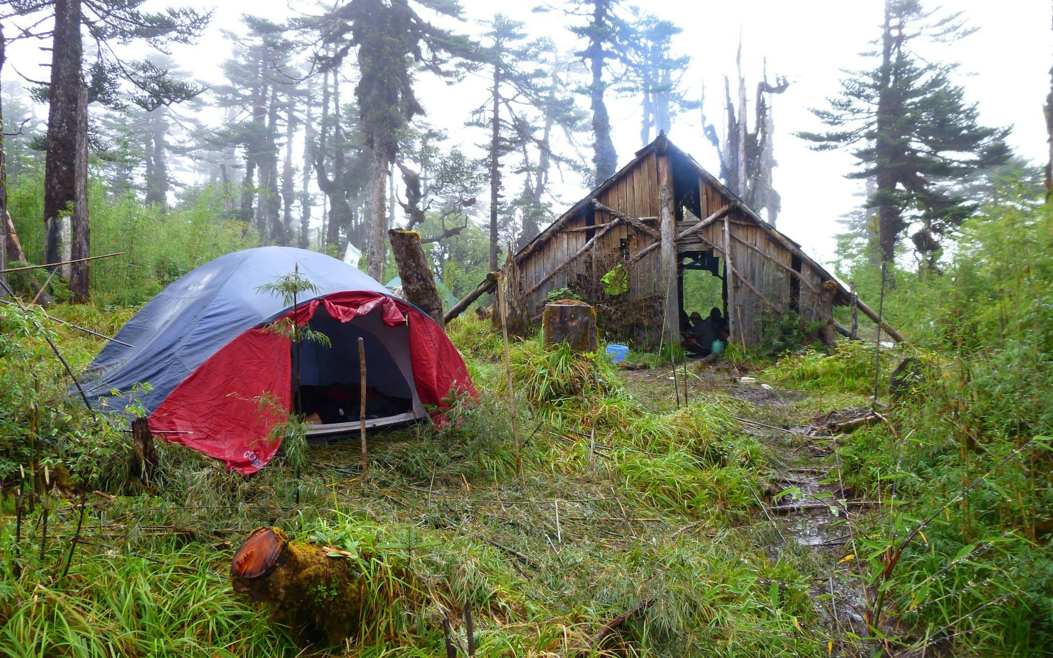
Beyond Kuging there are no villages and no buildings, so the trek runs on tents — pitched each evening by the crew at campsites in the forest, along the ridges and beside the high lakes, with meals cooked over the fire. Government guesthouses at Jengging and Tuting cover the nights on the road either side.
“Ten nights under canvas, from rhododendron forest to the edge of the sacred lakes.”
Why Travel With Greener Pastures?


Curated Experiences
Our itineraries are one of a kind, curated from our own personal travel experiences, from choosing the best logistically correct routes to the most interesting stay options.
Native Guides
Our tour guides are native to the region, and bring you an insider view into the life and culture of Northeast India, sharing with you authentic local experiences and fostering friendships.
Experts in Tours
When traveling with Greener Pastures, you can be assured that you are in the hands of experts who are knowledgeable and passionate about the region. Expect hassle-free, easy-going, and insightful travel.
“By choosing us, we share together a pledge towards responsible tourism, and share a belief that travel has the power to positively transform local livelihoods, cultures and environment.”
— The Greener Pastures Promise
Read the travel guide to Arunachal Pradesh for the seasons, the festivals and what else is worth the detour.


Travel news from Northeast India.
Stories from the field, our upcoming experiences, and other travel related news from Northeast India.